Pages

Wednesday, April 5, 2017

Dayton to Logan to Loveland to Home

Ohio. Not what typically comes to mind for a springbreak trip, but it was a perfect fit for our family.

We started with a two hour drive to Dayton to the National Museum of USAF. This is a free museum showcasing mainly airplanes from the very first airplane, through wars, and presidential planes. We spent 5 hours taking in as much as we could. We saw all the indoor planes, but skipped the outside exhibits. The kids (ages 4-9) enjoyed seeing all the various planes, but towards the end, my youngest had her fun bucket of airplanes filled. 

Next, we drove two hours southeast to Logan, OH which would be home for us for two nights as we explored Hocking Hills State Park. This place is known for its cliffs, waterfalls, recess caves, and gorges. It did not disappoint. The predicted weather was not in our favor for hiking, but we came prepared with boots and rain coats. It was just enough overcast and slight rain that rain coats were not needed.

There are 5 different parts to explore. Trails connected several of these parts. Due to the expected weather and young kids we opted for the shorter hikes at the features, but still ended up hiking 8 miles the first morning.

Old Man’s Cave was the first area we explored. It was the most popular area and we could tell by the trash left from the weekend. Old’s Man cave gave a great first impression. They made the bridges in a way that didn't take away from the view. The kids loved the recess caves and waterfalls. There were several waterfalls, rocks to climb through in this area that kept my kids hiking from one to the next. We hiked to Cedar Falls from here that was an easy/moderate hike. 

Devil's Bath
Waterfalls in the Old Man's Cave area
A few of the fun bridges
one of several cutthroughs
 
A short drive from Old’s Man Cave was Ash Cave. This was a free falling waterfall in a gorge. We could hike behind it which is always fun. 

One of the tallest waterfalls in Ohio - Ash Caves
 About a 12 miles from Ash Cave, we explored the Rockhouse area. The story is that outlaws used this as a hideout back in the day.  Which after seeing it, it would be an ideal place to hideout and well protected from weather. 
Rockhouse
View from one end of the Rockhouse
After taking a break at our cabin at the state park, we headed to Conkle's Hollow Nature Preserve. Part of this trail was paved, but overall an easy hike to the waterfall. This is suppose to be one of the deepest gorges in Ohio. We opted not to do the rim trail due to impending weather. 

A fun creek crossing right before you saw the waterfalls
 
Conkle's Hollow Falls
The next day as we headed out, we explored Cantwell Cliffs which claims to be one of the picturesque places in the area. It was the farthest away - about 14 miles. There were two free falling waterfalls. The beginning parts of the trail were the most rugged that we hiked in the area, so needless to say my kids loved it. 

This is called the Fat Woman's Squeeze. However this is wider than the one in Natural Bridge State Park.
One of the waterfalls. This one you could walk behind it as well get close to it at the bottom. 
 
I loved seeing all the exposed roots on the trees and how they adapted.

We saw alot of waterfalls thanks to the wet weather recently. In the summer some of these would be but a trickle if that.

On our way home, we stopped at Loveland Castle near Cincinnati. It was $5 per person to tour the castle with our youngest being free. It was a fun stop to hear the story how one man built the castle and see the armor and swords inside. 


Several types of armor on display
Overlook from the castle. KOGT stands for Knights of the Golden Trail.
With airplanes, waterfalls, caves, and castles, my whole family got to experience and see some of their favorite things. We are already looking forward to exploring some more in Ohio soon.

Until next time....


Monday, March 27, 2017

Via Ferrata at Torrent Falls

March is always a fun month. Not only do we see signs of spring and more daylight hours, but we also have two birthdays in our family to celebrate. Mine is on the 28th and my middle child is on the 29th. As I have gotten older and with kids, more focus of course has been on them. Last year, I decided I wanted to start a new tradition. Gather a few friends and go do. Last year we took a class at Suspend learning about aerials with trapeze and aerial hoop. This year I opted on Via Ferrata in the Red River Gorge area.

view from climbing up to the climbing area
 Via Ferrata at Torrent Falls describes it as "a way of climbing that consists of a steel cable that is attached to the rock face every 8-10ft.  Climbers are clipped into this cable with specialized via ferrata climbing lanyards.  Iron hand and foot rungs aid the climber as they ascend, traverse, and descend the course." This seemed like the perfect new experience to start my last year in my 30s. 

The company recommends reservations so I made one a few weeks in advanced. They just opened for climbing season at the beginning of March. Since there was just 4 in our group, we did not need to pay anything at the time of reservations. Their website was full of information on what to wear, bring etc. 

Our climbing adventure day arrived. My 3 friends and I packed the car with lunches and drinks and headed out for our 2 hour drive. It is just a few minutes down the road from Natural Bridge State Park in the Red River Gorge area. We arrived a few minutes early, but was able to sign the waivers and get checked in. We had about a 40 minute training session where we learned how to put our harnesses on, helmets, and practice on the training wall. Once we finished, the guides let us loose to climb.
section 2
section 2
 
There are 6 courses that you can climb ranging from easy to expert. You pay for an all day pass, so you can climb as many times as you want. They suggested Section 2 for us since it was our first time. This was harder than I expected even on the easiest one. I expected rebar for feet and hands all the time and the cable to not have so much wiggle room. There were always places for feet and hand grips, but it could be rock face, crevice. You were always attached to the cable, but for the first go around, definitely hard trusting the cable. 

We all made it through Section 2. My friend, Marian, and I opted for Section 3 after we all had lunch and debriefed about what we just did. Before we entered back into the climbing area, the guides checked all our equipment. Section 3 was intermediate level and went behind the waterfall. There were a few tricky sections such as climbing over a cliff to scale the rock face, but I always felt I had great hand or foot holds that made me feel more secure than section 2.

section 3 climbing over and scaling
 

 Next we tackled Section 1 which was more climbing up and down on the rock face. My last section I tried was the tight rope section. My arms were getting tired. I was also nervous not knowing the handhold on the remaining advanced courses, if I could complete them. The tight rope section you can climb to just that part, walk across and then climb back. The walking across was the easy part. Scaling back was more challenging considering I had to cross a gap between two rocks faces and I was getting fatigued. 

section 1
 
Tightrope


climbing back after the tight rope


Via Ferrata is for ages 10 and up. If you join their email, they send out discount coupon occassionally. They are open in all weather, but if storming, they wait it out. They sell gloves for climbing for $5. I brought cycling gloves, but felt they were too slick for me. I opted for no gloves. By the end of the day, my hands started to hurt from the death grips and knuckle scrapes. We arrived at Torrent Falls a little after 9am and left a little before 2pm

The via ferrata was a great experience. I loved the new challenge and experiencing it with friends. We each faced different fears, overcame, and met our limits. I would like to go back again and try the advanced sections.  Since we were so close, we stopped by Natural Bridge State Park for a short hike that ended up being 3 miles. I can't think of a better way to spend a day with some of my best gal pals.


Sunday, March 12, 2017

Land Between the Lakes 60K- First Ultra Marathon!

My first ultra has finally come and gone. I have been actively planning this race for a year. I had hoped to run the Rough Trail Ultramarathon in November last year, but had my head and neck cancer surgery that same week instead. Needless to say this weekend of racing was bittersweet.

A group of 6 of us from my running group, Moms Run This Town, had signed up for the various races. Two were running the 23K, two the marathon, and then two running the 60K. No one was running the 50 miler which was the last distance this race offered.


It took us about 3 hours to travel to our race destination in Grand Rivers, KY. Packet pick-up was quick and easy. We then headed to our cabin we rented at Moors Resort to finishing getting ready for our race and have our dinner.
our cabin for the weekend

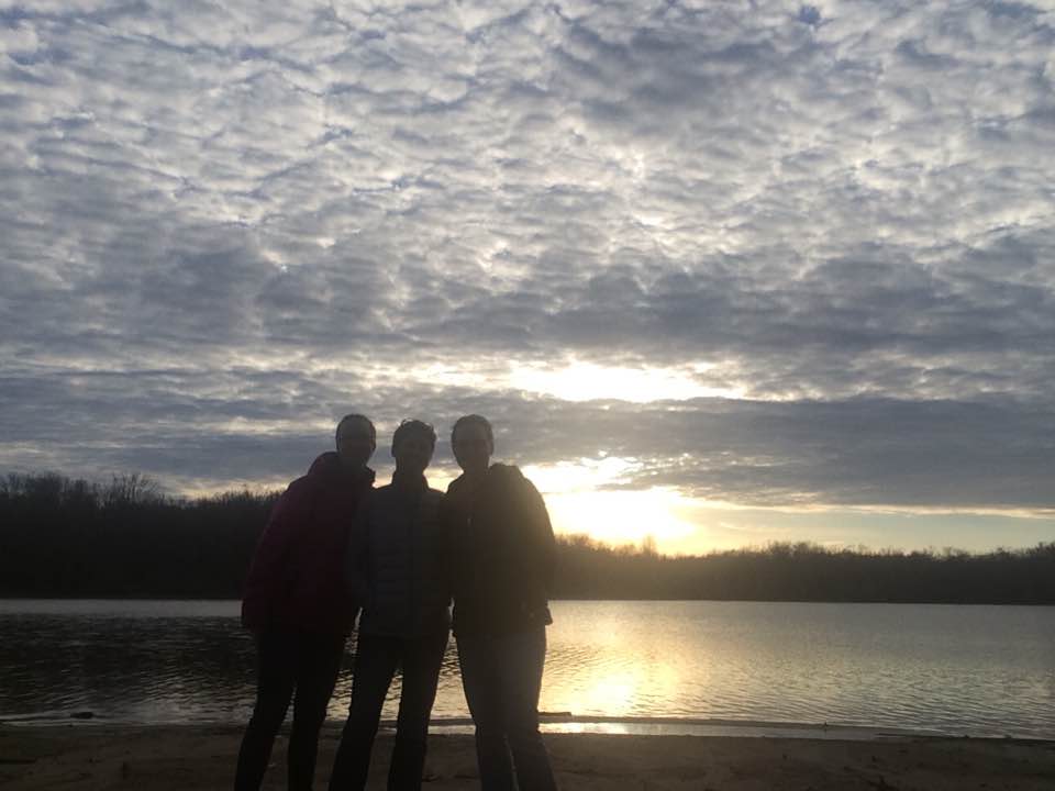
sunset outside our cabin
The race started at 6:30am central. We knew we had about a 20-25min drive to the race start in the morning. As we opened the door to head to our car, around 5:15am, we see all the snow! There was a light ground covering and it kept coming down. It was so beautiful! All week we had talked about the weather. It had gone from 70 and rainy to 40 and rain to 30s and snow and then back to rain in the mid-afternoon. In reality, we had a chance for a little bit of everything come race day!
pre-race photo
We made it to the race in Grand Rivers next to Kentucky Lake in plenty of time to visit the restrooms, drop off the drop bags, and walk about 7-8 minutes to the start line. As with typical trail race starts, it was pretty low key. The first 1.9 miles were on the road. My friends, Amy and Marian, and I all started together. We knew we wanted to start out conservative at the beginning, so we kept checking our watches to help with pacing. Apparently, my GPS watch was off a minute or two, so I thought we were right where we wanted to be. However, Amy and Marian's watches had us going 1-2 minutes faster. The funny part is that we talked about pacing not realizing my watch did not match their watch.
I am the one with the blue pack
Snowy trails to start the race
  Anyways, we made it to the single track trails ready to start our first loop. The snow continued to fall pretty much the first 5-7 miles of the races. It was gorgeous to see the trees covered and views of the lake. As expected most of the first loop, you were running with lots of other people and if needed to pass, it took a little while. There were some trees across the path, few creek crossing with little to no water, bridges with chicken wire on them, and mud. Lots of muddy running. The aid stations were about every 2-3 miles with water, SWORD, food, and restrooms. I had packed all my food: sport beans, honey stinger waffles, paydays, and lara bars for the day, planning on stopping as few times as possible. I also carried Tailwind, SWORD, and water. I ended up with mainly using the liquid forms of fueling. I stopped at one aid station on the first loop to refuel a bottle with SWORD and to use the restroom.

About 2/3 of the way through the first loop, we caught up to our friend, Jennifer. We got to run with her until the start of the our 2nd loop where she headed to the finish line for her 23K. I had two more loops to do. I was still feeling pretty good at this point. My goal was to continue to run on feel. With runners more spaced out, it was easier to go the pace you wanted. I wanted this loop to still feel easy. I stayed hydrated and fueled, checked if anything felt tense, hands relaxed, etc. On this loop, the trails were getting slick and even muddier in some parts. I decided to run the runnable parts at a bit more faster pace knowing I would be walking through the muddier parts to be safe and use the free speed that downhills bring. One spot of mud was the kind of mud that could take your shoe off. Fortunately, my shoes were on tight enough, that I didn't lose it. By the end of this loop, my hips were sore and blisters were forming on my right foot, but still feeling strong.

As I started, the third lap, I knew I would be entering unknown territory for me. I had yet to run over 26.3 miles. My biggest weekend mileage was 31 miles between two days. I knew my legs would be tired. I knew I would be tired of seeing everything for a third time. I also knew that I had run it two times and definitely had another lap in me. I wanted to still run based on feel, but knew it would take a little more effort to maintain the pace I started. The runners were even more spaced out, but I would catch up to some every half mile or so. Again the trails were in worse condition.  Fortunately, these trails were not as technical or as much climbing as I had trained on at Jefferson Memorial Forest. This lap I stop by the drop bags and put mine into the take back pile. I did not need to change shoes or shirts since the weather stayed dry. With 11 miles left to run, I started counting down the miles and focusing on the miles I was in. I thought people in my life - my family and friends. I thought about Kaiya who I run for that has CP, the people I had met through Livestrong program, and others who have fought cancer. I thought about how blessed I am to be running and not fighting cancer. It kept me going.

I finally made it back to the road to run the 1.9 mile back to the finish. The road miles back to the finish were the hardest. The concrete was tough to run on with tired legs that were sore. But knowing I only had less than 2 miles kept me motivated. As I came up over the last bridge, I could see my friends at the finish line and even saw one of them finish a few minutes before me.
I.am.an.ultrarunner!

So bittersweet to finish an ultra after the unexpected journey it has taken me on. When I finished, the lower half of my body was so sore. I definitely had the long run swagger. My friends and I waited a little while longer to see our friend (and my training partner) finish her first ultra. It was quite the experience.

I surpassed my goals. I was hoping to be in the 8 hour club and finished in 7 hours and 10 minutes. My pace was pretty consistent the whole race ranging from 11:00 to 14:05 minute miles. The few slower miles were ones waiting for the restrooms and refueling my waterbottles with SWORD. I also slowed down and walked the muddy areas more after the first loop.

Overall, this was a great race for a first ultra: plenty of aid stations, easy trail to follow, and not a technical trail (besides the mud). I learned I am not a fan of multiple loop races, but understand the benefits from a race directing standpoint with volunteers and ease of aid stations.
This race provided a fun opportunity to see another part of Kentucky that I have not seen before and share it with some fabulous running friends. Onto the next adventure!

Tuesday, February 28, 2017

Livestrong Program at the YMCA

Today was a graduation day for me. I graduated from the LiveSTRONG program at the YMCA!

This free program is for cancer survivors. The whole family is able to enjoy the Y's amenities for those 3 months for free. Since it is a free program, the YMCA has annual fundraisers to help keep this program free. The Greater Louisville YMCA has several branches to choose from for the program. Fortunately, the Y closest to me had times that fit in with my schedule: every Tuesday/Thursday for 90 min in the morning.

The program is 12 weeks and focuses on cardio, strength, and flexibility. It starts where you are fitnesswise and works towards your goals.  Every cancer patient has their own unique journey and recovery story. This program helps address the weaker areas to "Recover Strong" as they have as the slogan on the back of the shirts. I was fortunate enough to be able to start the program a month after my surgery. Having only surgery and already a runner, I knew I was ok in the cardio area, but needed help in strength and in the flexibility - especially my neck area.

The first two times you meet with the Livestrong coordinator are pretty casual. You get to know one another, share your story, and  might be able to meet a few of the other participants. You also have pre-assessements that measure your resting HR, cardio during a 6 min walk with post HR check, balance test, some flexibility testing, and percent body fat.

Our typical meetups including waiting for everyone to arrive and then start some cardio. We all did 30 minutes, but this could be less if needed. We had treadmill, elliptical, cycling, and rowing to choose from each time. Once the cardio was over, we headed to the strength component. This was individually based. We all started with the machines that our coordinator help set up the right starting weights and correct positioning for the machine. As we moved along in the program, Kate, our coordinator, offered up some additional strength training exercises that would help meet our goal. I was interested in the free weights and TRX, so I was able to get some instructions and tips on that area to continue building my strength after the program. Once we finished strength training, we stretched. This is really where I made some great headway with the flexibility in my neck.

Kate was there to help, but it was really us that had to put in the effort and dedication to reach our goals. My goals were to be able to swim - which meant I had  my mobility back in my neck and to be a stronger runner than before. I have been able to swim a couple of times, so that goal was met. My neck is definitely sore after the swims, but I can do it. Based on my post assessments (the same as the pre-asessments), I am stronger than I was. I gained 4lbs of muscles. My 1 rep max on both my chest press and leg press both increased significantly. I can already tell a difference in my running on the trails. My arms feel stronger and my legs can endure longer.

I am thankful I was able to participate in such a great program. Yes, there were times I did not want to go, so it was nice to have someone to meet there excited to see you and how you were progressing. Meeting up with other cancer survivors and hearing their journeys was also inspiring.

If you or someone you know is a cancer survivor, make sure you find a Livestrong program or something similar to participate. My mom, a 5 year colon cancer survivor, participated in a similar program. She had it all during treatment: surgery, radiation, and chemo! Her program introduced her to a gym as she was never a gym goer and made her so much stronger. She continues to participate in regular classes now. If you have any questions or think I could help in some way, please shoot me a message. Going through cancer and recovery is not easy, but having an ever growing support group can only make you that much more stronger.

Sunday, February 26, 2017

Running at Charlestown State Park

For the past 2 months, my running has pretty much consisted of Jefferson Memorial Forest, Creasy Mahan, or country roads by my house. These are all great training places for my upcoming trail race, but I missed checking out new places.  I was pretty excited when my trail running sister, Marian,  suggested exploring a new park recently to change it up a bit. I offered up Charlestown State Park in southern Indiana which is about a 40 minute drive for both of us. We could run all 7 trails for about 13 miles. Neither one of us have been there, so the decision was pretty easy to check it out.

We carpooled from Kentucky, traveling over the new toll bridge over the Ohio River. The bridge was just finished this past December and has made traveling to my home state of Indiana much easier for my family and I.

The park was pretty easy to find just off of 62 with a big sign out front. Since we visited during the slow season, it was free to get in the park. Otherwise, out-of-staters have to pay $9 and in-state is $7.
We grab a map at the gatehouse. The park was really easy to navigate with just one main road and signs with the trails on this main road.

We typically run with our hydration vests and fuels, but fortunately with all the trails being under 3 miles we were able to leave these in the car and hydrate after each trail. When we started running the temperature was 28 degrees, frozen ground,  so we did not have to worry about our water freezing with them in the car.

Here is a brief summary of the trails.
Trail 1: This trail is marked as a rugged 2.4m trail on the park map. The footing on here was rocky and rooty in some parts. There were some cool big rocks that the trail went through along with overlooks of the Fourteenmile Creek. My Garmin got about 2.3m with 285 elevation gain.

Trail 2: This trail is marked as a moderate 1.4m trail on the park map. This had some small waterfalls that were fun to see along the trail. We got about 1.3m with 135 elevation gain. Everything was very runnable on this trail.

Trail 5: This trail is marked as a moderate 1.2m trail. It is located in the campground area. There is a platform overlooking the creek that was beautiful to see. I can only imagine what it would look like in the spring with the spring flowers up. We got 1.7m with 148 elevation gain. It was all pretty runnable as well.

Trail 4: This trail is marked as a rugged 2.9m. This was probably my least favorite trail based on scenery. The views from the other trails were just a little bit better in my opinion. However, we were on a quest to run all the trails today and with the sun shining in our faces we kept going. It seemed if a trailed was marked rugged, it was usually because of some elevation gain as well as some tricky footing with rocks and roots. This trail came up as 2.7m with 276 elevation gain.

Trail 7: This trail is marked as an easy 0.9. It is called the Rose Island Loop Trail. We started our running watches really at Trail 3. About the first half mile was a paved, steep downhill leading to a Portersville Bridge across the Fourteenmile Creek to Rose Island. This was one of my favorite trails. Rose Island used to be home to an amusement park in the 1920s. However, with the Great Depression and the flood in 1937, it was damaged beyond repair. Signs were around this trail with pictures and stories about the amusement park. With part of Trail 3 on our watches, we came up with 1.5m  with 59 elevation gain.
Portersville Bridge to Rose Island
Rose Island sign
Remnants from where the dance hall was. There also remnants showing where the pool, cottage, hotel. dining hall were located.
One of my favorite views.
Trail 3: This trail is marked as a rugged 2.1 miles. It loops by Trail 7. Part of the trail is paved as mentioned above and the other part is on the trail. Parts of this trail were very rocky and the climb up/down could be slippery if it had been more wet. This trail came up 1.5 on our watches since we did not include the pavement portion that we included for Trail 7. This had 302 of elevation gain.

Trail 6: This trail is marked as a rugged 2.3miles located at the far end of the park along the Ohio River. It had a steep climb at the start with bigger rocks to climb through. Then we ran along the bluff overlooking the river seeing the Kentucky side of the river. We came across a bridge overlooking a waterfall that was beautiful, but no really good places that had an overlook to it. Once crossing the bridge we figured out that the Trail sign had been turned around so we turned it back and continued on a descent to run along the river. Once along the river, it was an easy, flat run back to the car. We got 2.3miles with 272 elevation gain for this trail on our GPS watch which was spot on.

Rocky climb up to the bluff.


The fun descent down to the Ohio River.
The waterfall with no good overlook to it.
This park would be great to bring the kids and a picnic or even go camping for a night or two. They did have two playgrounds and some open fields to fly kites, play ball or whatever else your family may enjoy. 

This is just what we needed as we head into taper week for our first ultra - a 60K.  I would not want to run there after a rain. As the morning warmed up and the ground thawed, there were some slick muddy spots along the trails. The climbs were easier than Jefferson Memorial Forest. We still got 13+ miles in with 1000+ elevation gain. Bonus, we got to see the Ohio River from the other side for a change. It did not even feel like a training run for me. It felt like I was just out exploring in the woods with a friend stopping to enjoy the journey along the way.


Saturday, February 18, 2017

6 hour AR: Carter Caves

June 2016.
6 Hour Adventure Race.
Kidfree weekend getaway.
That is how we roll.

My husband and I signed up for my longest adventure race late last spring. This race is part of the 361 Unbridled Series. It is the first one in the 3 part series and the shortest of the three. The other two are an 8 hour and a 12 hour, both held at a Kentucky State park as well. The race consists of orienteering (navigation), paddling, running, and mountain biking. You are given a map with several points that your team needs to go find in the woods. You have 6 hours to find as many points as possible using any of those three modes of transportation with the map and a compass, but arrive to the finish line late and you get penalized. 

Depending on the race, you get the map with the points or you have to put the points on your own map. This race we had a map with them on it, plus we were allowed to use the park map with the trails on it. This was helpful for us. We placed to checkpoints on this map as well. 
We used the map the gave us plus the park map.
These races have a little bit of everything: running, paddling, biking, off-the trail exploring while hoping to not lose contact with the map plus strategy. If you are racing in teams, you want to play to everyone strengths. We are a strong running team as compared to mountain biking. We are better off leaving bikes at different points and then running. However on this race, the biking trails were also horse trails, so they were beat up. We actually did not use our bikes at all on this race. We canoed to different ends of the lake, parked our canoe and ran to several checkpoints.
Ryan portaging our canoe down a huge hill that we also had to carry up. Thanks to our friends, Salmons, for letting us borrow their lightweight canoe.
  Being out in the middle of nowhere, means there is specific gear you need to have with you to be safe. Each adventure race may have slightly different gear requirements. In this race, each person needed  headlamp with extra batteries, hydration, fuel, space blanket, whistle, and a sharpie. Each team needed a first aid kid, compass, fire starter, fully charged cell phone. For the bike portion, we needed a helmet, light, inner tube, patch kit, pump or CO2 cartridge, and bike tool. For the paddling section, we needed life vests and paddles. The longer the adventure races the more gear you need. 
Ryan getting our checkpoint. (See that fluorescent green person?)
Carter Caves was a great location for the race. It was our first time there and there were some spectacular views and arches to see. Near the end of the race, I was getting fatigued and things were all running together. As you tire, it gets harder to focus on the map to locate points. Fortunately, Ryan did the navigation. He would tell us our back stop and what we were looking for so as we ran we were looking for these things. Since I was getting tired, we headed back fairly early - 29 minutes to spare. We came in third place in our division. Not a bad showing for our first time in a 6 hour adventure race.

All packed up to head home.
361 and DINO both host 4 hour adventure races to try it out if you like in the Indiana and Kentucky area. There are several other groups that hosts these races if you just google for them. There are also orienteering clubs that can help teach you or improve your navigation skill as well. These races are usually just fun races that break up the monotony of having to follow a specific course in a running race. I definitely recommended giving it a try.
A natural bridge at Carter Caves